Current map: Version 8.2
Special maps (not automatically updated; tell me if you want a new one):
- Blankish Map (without labels or border colors)
- MCS-Style Map (simple colors, no terrain relief)
- MCS-Style Blank Map (simple colors, no terrain relief, no labels)
Current issues to change for version nine of the map:
Byzantipol
Please post map change requests below.
Map Information/Update/Request Thread
-
Scott Alexander

- Posts: 1778
- Joined: Sun Dec 19, 2010 1:20 am
-
Andreas the Wise
- Posts: 2189
- Joined: Tue Nov 23, 2010 11:40 pm
Re: Map Request Thread
I can tell you my location, I don't have a name yet. I've settled on the inland bit in the middle of Calaspiria, between the two forks of the river and extending down into the mountains proper. Petering out about where the gridline crosses the mountains, but obviously give it a natural border, not a straight line - I just want to include some proper mountains, and have the rest of it bordered by the two rivers. I will work river-borders into the statelet concept. And that's the two rivers near Myëë Sëyëe, not the two near Col.
The character Andreas the Wise is on indefinite leave. But he does deserve a cool war ribbon.

However, this account still manages:
However, this account still manages:

Re: Map Request Thread
I've just registered Merveilles. I'm interested in the area south of that mountain range south of Drachumve. The north and eastern bordes of Merveilles should be those mountain ranges. The capital city is located at the source of that river and named "Quadropoli." Roughly this:

Thanks
Thanks
The ghost of Nathan Waffel-Paine
-
Sammy J McMillan
- Posts: 112
- Joined: Fri Mar 04, 2011 9:23 am
Re: Map Request Thread
Could you add Ivanov as the capital of Col? Map here, it's on the western banks of the western river.
Sammy J McMillan
ANTICAN LIBERATION DEVICE. Allow curiosity to seduce ya: http://www.bastionunion.org/forum/viewt ... =320&t=992
Citizen of the Republic, friend of
ANTICAN LIBERATION DEVICE. Allow curiosity to seduce ya: http://www.bastionunion.org/forum/viewt ... =320&t=992
Citizen of the Republic, friend of
In the quotes thread, Ardy wrote:You know, you are a bit of an arse - even by the standards of this hobby (which is an achievement).
-
Kallinn Ynnetrrr

- Posts: 388
- Joined: Fri Mar 04, 2011 1:10 am
-
Scott Alexander
- Posts: 1778
- Joined: Sun Dec 19, 2010 1:20 am
Re: Map Request Thread
The map has been updated to Version 3. You can find the new map here. Changes include the addition of Merveilles and Northwood, the labeling of Those Who Shelter Words, and the addition of capitals Real Diamond, Quadrapoli, [Safirian capital name], and Ivanov.

Re: Map Request Thread
If I could put in a request for the following? (eastern half of the large-ish Eorlasian isle north of The Favored)

If I need to cut the claim down, let me know. I can hack off some of the eastern end without affecting my plans overmuch.
If I need to cut the claim down, let me know. I can hack off some of the eastern end without affecting my plans overmuch.
Shyriath Farstrider (aka Shyriath Bukolos), KD MOU OLH XBH
Viscount Farstrider of Erysisceptrum, Count Bukolos of the Condo, Harbinger of Cheese
TOTUS MUNDUS TABULAM RASAM EST
Viscount Farstrider of Erysisceptrum, Count Bukolos of the Condo, Harbinger of Cheese
TOTUS MUNDUS TABULAM RASAM EST

Re: Map Request Thread
From the "Geographical Survey" thread:
Craitman wrote:Myëë Sëyëe's capital is really just de facto. The community on Myëë Mŷwr is usually the place where the state's official discussions are held, so I guess that's as close as you're going to get for a capital for us. Just put a capital symbol on the larger island and label it "Myëë Mŷwr"

Re: Map Request Thread
I request the map be updated for Aryasht now that the resolution has passed.
The Great King, King of Kings, King of the World
Re: Map Request Thread
Also for Aryasht, the capital Aryapur is slightly too far to the north. It should be moved very slightly to the south.
The Great King, King of Kings, King of the World
Re: Map Request Thread
Final question: in terms of scale, what is the approximate size of Aryasht compared to a real world country?
The Great King, King of Kings, King of the World
-
Kallinn Ynnetrrr
- Posts: 388
- Joined: Fri Mar 04, 2011 1:10 am
Re: Map Request Thread
Actually, I would like to know the scale of the map as well for the purpose of determining the dimensions of the SynnHalla map.

-
Scott Alexander
- Posts: 1778
- Joined: Sun Dec 19, 2010 1:20 am
Re: Map Request Thread
CJ is correct. [EDIT: No he's not, it's 7 miles = 12 km]
Aryeztur, you said it was at the mouth of a river. Is it at the right river but too high, or do you want it moved all the way down to the next river?
Aryeztur, you said it was at the mouth of a river. Is it at the right river but too high, or do you want it moved all the way down to the next river?
Re: Map Request Thread
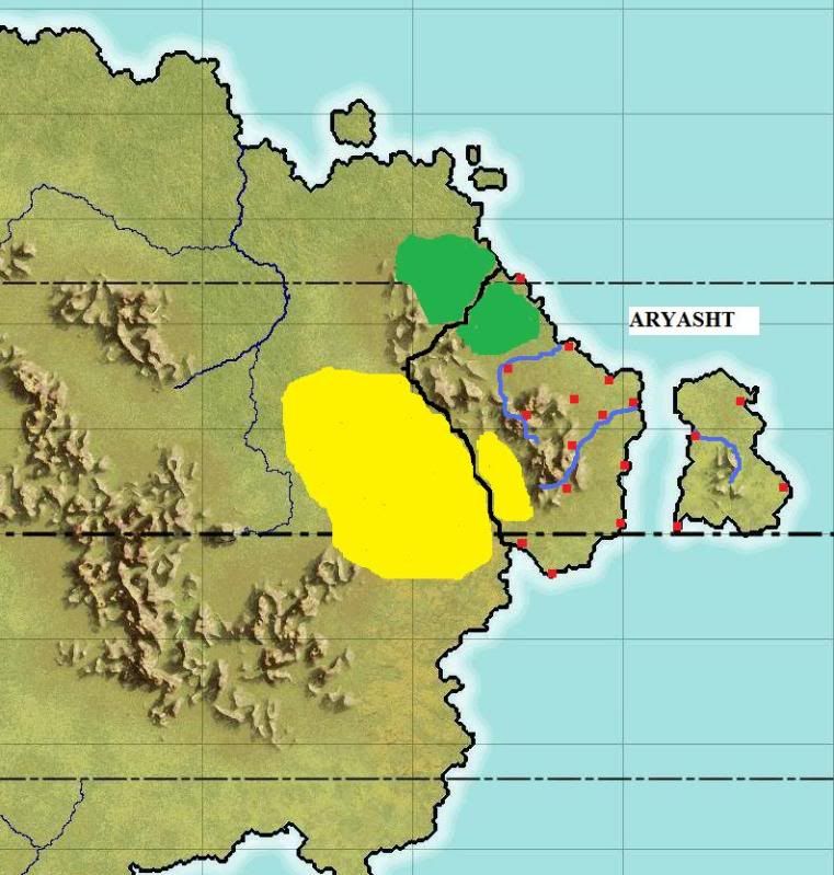
The map hasn't changed and this is the version I would prefer accurately represented on the official map. The capital as it stands looks like its on the corner of land to the north of the river, but the river's mouth is a bit south of that corner. You got the capital on the right river [there are two rivers on the mainland, its the southern of the two], but it looks like the mouth was moved north a bit. The capital is where the river and the sea meet, of course.
The Great King, King of Kings, King of the World
Re: Map Request Thread
The desert (Reg) might as well be included on future physical maps.
The Great King, King of Kings, King of the World
Re: Map Request Thread
Is it possible/easy to get a map of Merveilles without the name and city labels and symbol?
The ghost of Nathan Waffel-Paine
-
Carl Jackson
Re: Map Request Thread
Derp.Scott Alexander wrote:CJ is correct. [EDIT: No he's not, it's 7 miles = 12 km]
Re: Map Request Thread
Yes, 12 km sq? or is it 12 by 12 meaning 144 km sq?
The Great King, King of Kings, King of the World